Visualize & analyze EnMAP data with the EnMAP Box
Time: 4 hours
Tutorial description: In this tutorial, participants will learn how they can use the EnMAP-Box to visualize, explore, and analyze EnMAP observation data.
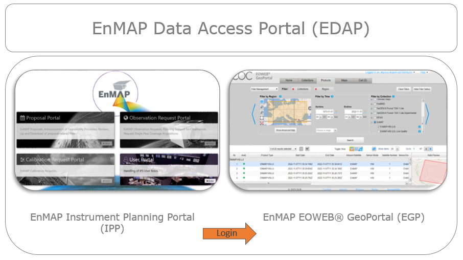
First, we show how EnMAP observations can be ordered in the EOWEB® GeoPortal (see EDAP) and will provide examples for all workshop participants (participant are welcome to bring their own EnMAP / imaging spectroscopy data).
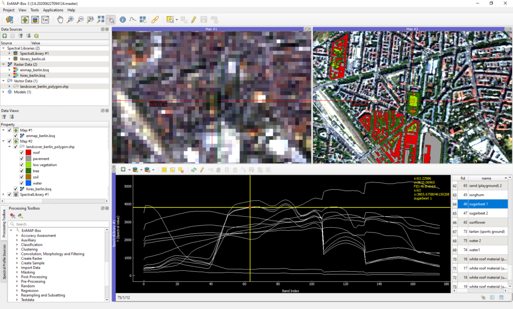
After that, we will learn how the EnMAP-Box can be used visualize the downloaded EnMAP observations, together with other raster and vector datasets. We will present the newest EnMAP-Box features to visualize hyperspectral raster data and interactively explore its statistical properties.
As an example, for the EnMAP-Box processing capabilities, we will show how the model builder can be used to set-up a processing workflow to unmix landcover fractions, and how this model can be used from within the EnMAP-Box, python code or a command line interface.
The second part of our tutorial focusses on the creation, handling, and visualization of Spectral Libraries. We show how spectral libraries can be created and “labeled” based on QGIS vector layers. Participants will learn how data collected in field campaigns can be assigned to profiles in an EnMAP-Box spectral library, and how to export spectral profiles into other data formats.
Prerequisites: Participants need to bring their own laptops with QGIS 3.28 (LTR) or QGIS3.34 (latest release) and the EnMAP-Box plug-in 3.13 preinstalled. See installation instructions here.
Presenters information

Andreas Janz is part of the EnMAP-Box development team since 2007. He studied Computer Sciences at Humboldt-Universität zu Berlin.

Dr. Benjamin Jakimow is part of the EnMAP-Box development team since 2011. He studied Geography with Computer Science and Agricultural Sciences. In 2023 he finished his dissertation on land use in the Brazilian Amazon.
Neija Elvekjaer is a PhD student at Humboldt-Universität zu Berlin
working with EnMap data and unmixing workflows for vegetation and forest
fire applications.”