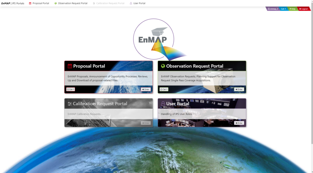
User Portal/ Proposal Portal / Observation Request Portal/ Eoweb GeoPortal
Instructor: Dr. Nicole Pinnel (DLR)
Time: 2 hours
Tutorial description: in this Tutorial participants will learn how to order and get access to EnMAP Data through the EnMAP Data Access Portals (https://planning.enmap.org/).
The Data Access Portal in general include two major entry points: the EnMAP Instrument Planning Portal and the EOWEB® GeoPortal.
Users can register, submit proposals, plan and request future observations in the EnMAP Instrument Planning Portal (IPP). Additionally, the EOWEB® GeoPortal (EGP) contains the full EnMAP Data Archive. Users can use this portal to search and browse and request archived data in different processing levels (L1B, L1C, L2A) on demand.
The proposed tutorial will consist of a short introduction to EnMAP data and products, and give some theoretical overview of the EnMAP Access Portals. It will follow on with some hand-on training where the following topics will be addressed:
- User Portal: User registration and Role Assignment
- Proposal Portal: Proposal submission for Science Users
- Observation Request Portal: Future observation request planning and submission
- EOWEB@Geoportal: Access to the EnMAP data archive and ordering of archive data in different processing modes L1B, L1C and L2A land, L2A water, L2A combined.
Prerequisites: For participants a completed user registration and an active user role (e.g. Cat-1) at https://planning.enmap.org/ would be helpful.
Please find more information on https://www.enmap.org
Presenter Information:
Dr. Nicole Pinnel has a background in physical geography and remote sensing, with over 20 years experience in the field of imaging spectroscopy. Her doctoral research at the Technical University of Munich primarily focused on using hyperspectral remote sensing to map underwater plants in lakes. She has a strong interest in water related remote sensing applications of shallow inland and coastal environments. Her research also encompasses species classification and monitoring biodiversity using high-resolution remote sensing data. She spent several years in Australia, where she worked in scientific organizations such as CSIRO Land and Water and Murdoch University, as well as in the private sector. During this time, she actively contributed to significant environmental mapping projects aimed at monitoring shallow marine benthic habitats and coral reef ecosystems. Since 2009, she has been employed at DLR’s German Remote Sensing Data Center (DFD) in Oberpfaffenhofen, holding the position of Application Support Manager for the EnMAP Ground segment.